
Walk a Windsor Street Directory
A sound by-address search starts with a precise place, not a person's name. Windsor Property Cards locates the parcel by street address or file code. GIS then separates the property location from the owner's mailing address and supplies the parcel shape. A deed establishes a transfer, while a voter or old directory result answers a different question. No source proves every occupant. Save the date and label the address type.
- Enter the address in Windsor Property Cards. Use autocomplete to learn the accepted street form and save the file code.
- Open the same site in the Windsor GIS viewer. Compare the situs, polygon, and owner mailing fields.
- Use the official voter lookup only for a defined query. Ask Windsor registrars about broader file access and current restrictions.
- Carry the owner, sale book/page, and legal description into the Town Clerk land index. Follow buyer and seller through each transfer.
- For past households, convert the modern address to its village, road, or trolley-stop form before checking historical directories.
The chain is address to parcel, parcel to owner, owner to deed, then to dated resident evidence. It prevents a tax mailing line from being called a home address.
A full street pass should keep one row per source observation. Record the address as searched, the normalized address returned, file code, named party, source date, and what the record means. Sort only after the notes are complete. This catches duplicate units, municipal parcels, trusts, and owners who receive mail away from Windsor. If a name appears only in a deed, call that person a deed party. If it appears only on a tax card, call that person or entity the recorded owner. The careful labels make the street directory useful without overstating residency.
Normalize Windsor Street Addresses
Windsor's live property search is strict about form. The inspected example accepted 275 BROAD ST, while the street type written in full did not produce that parcel. The town guide recommends short forms such as St, Rd, and Dr. Autocomplete reveals the stored form. Keep unit numbers and suffixes. Broad searches show 25 results per page and stop after 2,000 matches, so a whole-street pass may need a number range.
The Windsor Town Assessor page identifies the office behind the roll. Its portal searches by address or file code, not owner name or ZIP.
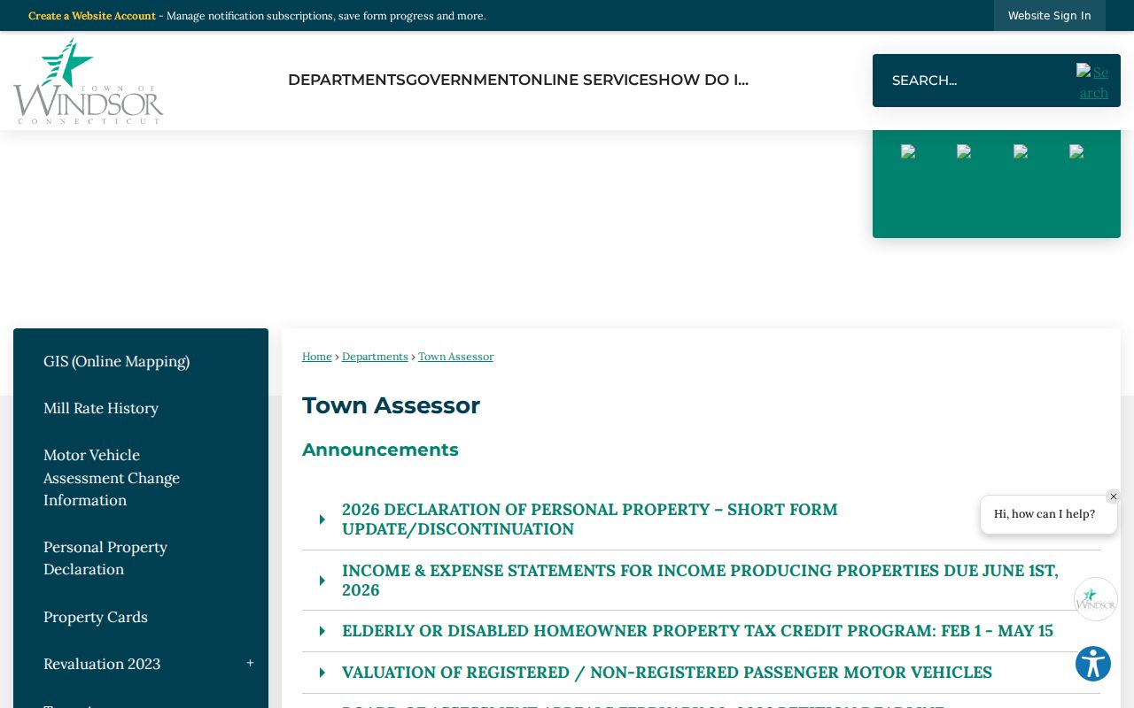
The screen gives the proper municipal route rather than an imagined Hartford County assessor.
For a named street, begin with the least ambiguous segment. Search several known numbers and note the spelling returned by autocomplete. Then widen the query. Do not assume an empty result means that no parcel exists. The stored record may use a direction, unit, abbreviated road type, or file code. A parcel can also be land without the kind of building a user expects. If the interface cap appears, divide the work by number range and keep the result-page count. This makes the Windsor by-street pass repeatable and reveals where the public interface, rather than the street itself, caused a gap.
Search Windsor Property Cards
The Property Cards field set is narrow. Search one address or file code, open the result, and save the PDF card when a stable copy is needed. A card may show owner and mailing lines, values, sale history, map/block/lot, building facts, a sketch, and a photo. Those facts describe a parcel, not its full household.
| Windsor control | Input | Required | Use |
|---|---|---|---|
| Street address or file code | Text/autocomplete | Yes | Find a parcel by stored street form or exact ID. |
| Search/Clear | Buttons | No | Run or reset the current query. |
| Owner name | Not present | No | No owner-wide search is enabled. |
| ZIP | Not present | No | No ZIP-wide filter is enabled. |
| Property card/PDF | Result control | No | Open full parcel detail and printable card. |
The inspected Town Hall property card joins one Windsor address to a municipal owner, mailing line, sale entry, map reference, and building record.
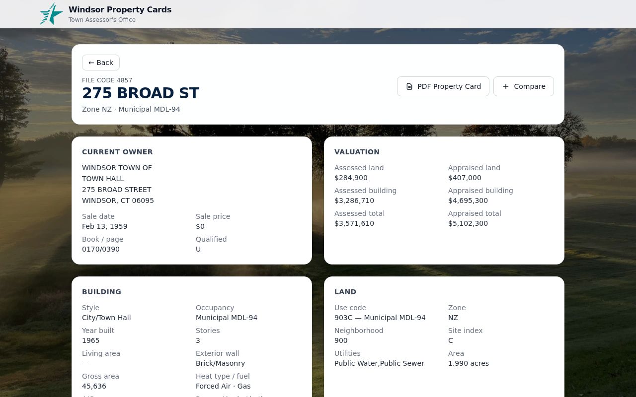
This public-building example demonstrates the fields without using a private home as the sample.
The Town Hall card shows why file codes matter. A street address can be rewritten or abbreviated, but the file code provides a stable join to the GIS and tax record. Map/block/lot offers another check. Sale history can point to a deed book and page, while the building panel explains the structure attached to that parcel. Values reflect the assessment system, not a household fact. Windsor's assessor states that taxable property is assessed at 70 percent of fair market value and identifies the October 1, 2023 revaluation cycle. Those valuation details help date the card, but they do not identify a resident.
Read the owner line and mailing lines separately. An individual, estate, trust, business, town agency, or other entity may own the parcel. Joint-ownership abbreviations can appear on the card. Mailing mail to the site does not prove use of the building as a residence, and mail sent elsewhere does not mean the owner has no Windsor tie. Sale price and qualification codes also need the town guide or deed for context. A zero-price municipal sample is not a normal market sale. The street directory should retain the printed value and code, then point to the instrument rather than supply a guess.
Browse Windsor Streets in GIS
GIS bridges a street string to mapped land. Identify a parcel, then click nearby polygons. The verified service holds the site address, normalized street parts, file code, owner mailing fields, site ZIP, owner ZIP, acreage, coordinates, and geometry. The web viewer's exact buffer controls were not verified, so use map browse and identify rather than promising a radius tool.
The Windsor Abutter Tool service shows the underlying parcel fields.
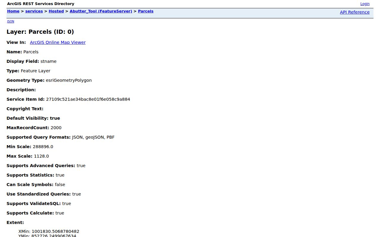
Separate situs and mailing columns explain why an address result must preserve both labels.
The GIS REST layer also supports SQL, pagination, distinct values, statistics, spatial queries, and common data formats. Those capabilities explain how parcels can be browsed systematically, but the web viewer remains the practical route for most readers. Start with a visible polygon. Confirm its site address and file code. Then inspect the polygons sharing frontage or a boundary. Numerical order alone is not enough because corner lots, backland, condominium units, and irregular shapes can place nearby numbers on land that is not adjacent. Save the map date or query date with each observation because GIS is a current snapshot, not a deed history.
- Parcel
- A mapped unit of land linked to a file code and legal map reference.
- Situs address
- The location of a parcel or building, distinct from its mailing address.
- Plat
- A recorded survey map showing lots, boundaries, roads, or subdivisions.
- Criss-cross directory
- A directory arranged by street and number so an address leads to a listed name.
Compare Windsor Street Records
A Windsor street directory is strongest when independent sources agree. Each has its own keeper, date, and limit. Connecticut does not operate a Hartford County recorder or assessor for Windsor, so town offices and statewide systems are the right route.
| Address source | Keeper | Evidence | Route |
|---|---|---|---|
| Property card | Windsor Assessor | Owner, mailing address, values, sale, parcel and building facts | Address/file-code portal and office |
| GIS parcel layer | Windsor GIS | Polygon, situs, file code, mailing-owner fields, ZIP, acreage | Public viewer and REST service |
| Land index | Windsor Town Clerk | Parties, date, book/page, document type and legal description | SearchIQS, INDEXBOOKS, or office |
| Voter record | Registrars/SOTS | Allowed registration, residence, status and district facts | Official lookup or approved request |
| Plans and permits | Building/Planning | Address, work, applicant/owner and plot-plan facts | OpenGov or office; public result search unverified |
The file code joins card to GIS. Book/page and the legal description join the parcel to the deed. Keep those links when street spelling changes.
Access channels also differ. Property Cards and GIS are available online. The Town Clerk permits office searches during posted weekday hours and supplies older index routes. Building and Planning may require an office request when a public result screen is absent. Voter access begins with the state lookup or local registrars. A narrow request under the Connecticut Freedom of Information Act can seek an existing address-based record, but it should name the record, department, date span, and desired format. It should not ask staff to investigate a private person's current whereabouts.
Courts can sometimes add an address-specific clue. Connecticut civil inquiry includes a property-address route, while probate may connect an estate or heir to a parcel. These systems serve different legal records and are not street rosters. Save the docket number and inspect the public file before using an address. Sealed, erased, protected, juvenile, and much family material is unavailable. Similarly, a Windsor Police address-history request concerns releasable reports and local statistics, not a list of every person associated with the address. The record type must stay visible beside the name.
Follow Windsor Streets Into Deeds
A property card supplies a sale clue, but the deed is the ownership source. Take the owner, date, book/page, and legal description to SearchIQS Windsor. Search buyer as grantee and seller as grantor, then repeat backward. Party, date, document, instrument, and wildcard searches are documented. Address indexing is not universal.
The Windsor Land Records page explains online and office access.
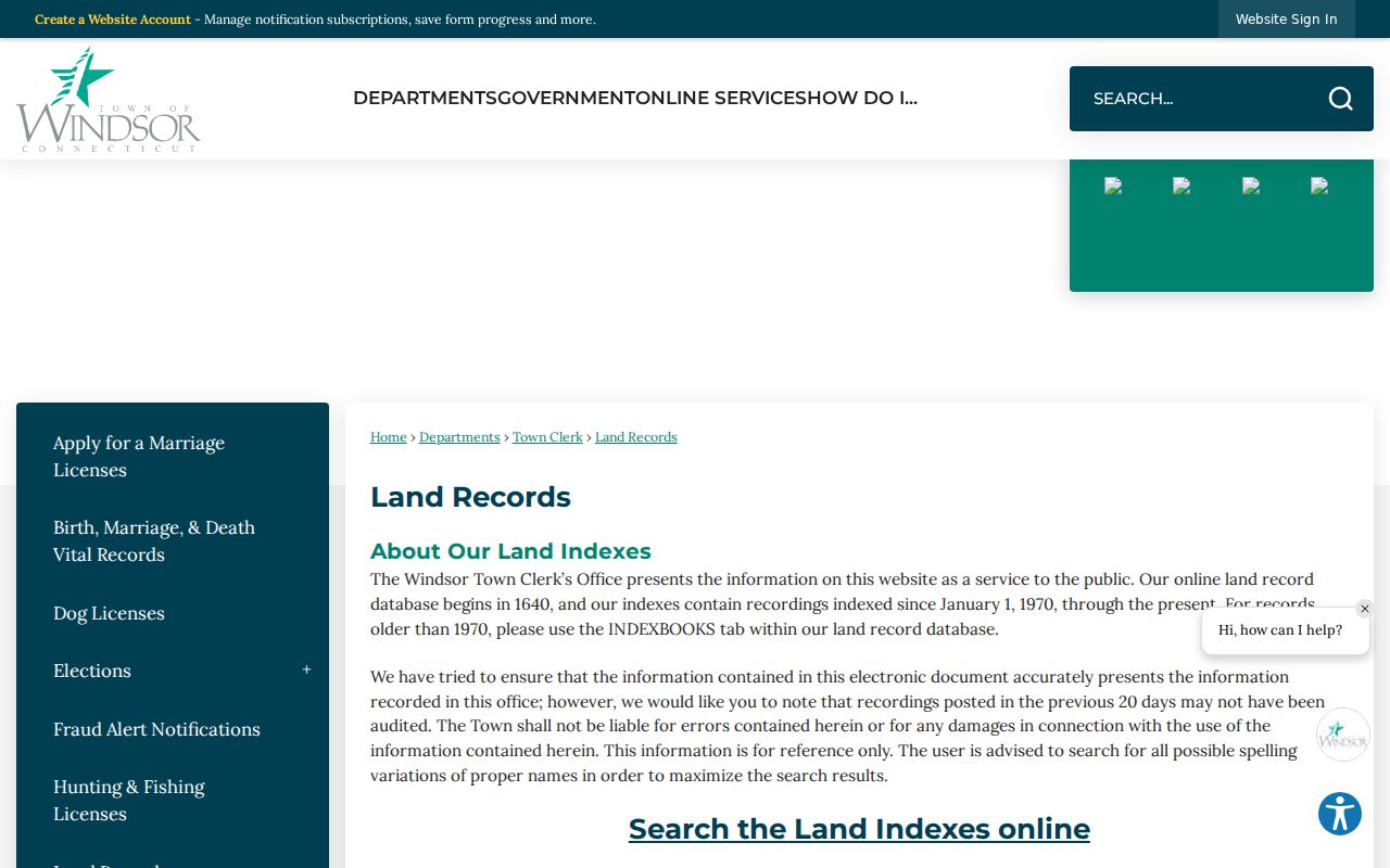
Recent online records may not be audited. Older work can require INDEXBOOKS or an office search, while the vendor lists modern index and image dates separately.
The town describes an index reaching to 1640 and directs older work to INDEXBOOKS. SearchIQS publishes land index data from January 1, 1970, images from June 26, 1971, maps from 1881, trade names from 2006, and foreclosure registrations from 2011. Present those as separate layers. They are not one universal digitization date. When a deed image is absent, note the indexed fact and verify the instrument with the Windsor Town Clerk.
A deed chain works backward through roles. The current purchaser is the grantee. The seller is the grantor. Find the seller's earlier purchase by searching that person as grantee, then repeat. Trusts, estates, spelling variants, initials, and name changes can interrupt the chain. Book/page, instrument number, legal description, and map reference are stronger bridges than a loose street match. Deeds may also show mortgages, liens, or fiduciary roles. Those records document an interest in land, not each person who occupied it. A certified copy or clerk verification is the final route when the exact recorded terms matter.
Check Windsor Plans by Address
Building and planning files can date work on a parcel. Applications collect the address, owner contact, work type, description, value, and contractor facts. Planning and Zoning describes a residential plot-plan and survey database, though it does not cover every property. OpenGov requires an account for applications, and research did not verify a public search of all past permits.
A permit proves a project link on a date, not that an applicant lived there. Address-pinned service reports serve the same narrow role.
Plot plans and surveys help when a street number points to several structures or lots. Windsor says its electronic residential plot-plan database does not cover every property, and copies can be requested through Building or Planning. A plan may show dimensions, setbacks, structures, or project context. It does not replace the recorded plat or deed. Note whether the file is an application, approved plan, permit, inspection, or later revision. The date and status can explain why a property card and map display different building details.
Windsor Streets Before Numbers
Windsor house numbers were not assigned until 1915. The 1909–1910 directory used trolley stops, including Wilson Congregational Church at 6½, Windsor Public Library at 28, Thrall School at 44, and Rainbow center at 70. This local quirk changes the search method.
Convert a current address to its road, village, landmark, and parcel description. Compare the directory with a map, deed, and house file. The Windsor city directory collections cover that shelf in depth. A missing number may reflect an old trolley or village label.
Windsor's early settlement geography adds another trap. Historical references to “Ancient Windsor” can include land later separated into Windsor Locks, East Windsor, Bloomfield, South Windsor, and other towns. Preserve the publication date and original place label before assigning a present municipality. Poquonock, Rainbow, Wilson, and Windsor center also act as local search terms. The right bridge may be a trolley landmark, church, school, business, cemetery, deed boundary, or old map rather than a numeric address.
Verify Windsor Voter Streets
Connecticut's voter system stores residence street and district concepts, but the public lookup was blocked during research. Do not promise a public list of everyone on one street. Use the official voter lookup for a defined query, or ask the Windsor registrars for current request terms.
A result supports a dated registration link. It never reveals ballot choices. Protected voters and Safe at Home participants remain confidential. The 2026 TotalVote upgrade makes old screen descriptions time-sensitive.
Internal system documentation describes street and name concepts, but it does not prove what the public screen exposes. Do not reproduce sensitive identifiers or full birth data based on an internal manual. Windsor election minutes publish aggregate district counts, which can describe the civic geography without exposing a street list. District statistics and a single-person registration lookup answer different questions. Keep them apart, and verify any current district assignment through the registrars after system changes.
Separate Windsor Address Layers
A parcel may sit in Windsor while its owner gets mail elsewhere. Its deed may use a legal description, and USPS may use a village. Poquonock's 06064 identity belongs in the Windsor area, while 06096 points chiefly to Windsor Locks. Postal labels do not redraw town lines.
Retain the query, situs, file code, mailing line, site ZIP, owner ZIP, legal description, and date. Units, corner lots, rear parcels, and shared drives can break a number sequence.
USPS delivery, town jurisdiction, tax mailing, voter residence, and emergency-service records can update on different schedules. A surprising ZIP in an official file should be preserved and labeled, not used to redraw Windsor. For a disputed delivery address, use USPS verification. For a parcel location, use the town map and assessor. For a deed boundary, read the instrument and recorded map. This comparison is slower than copying one search result, but it is the core of accurate street-by-street research.
Limits of Windsor Street Records
A useful street ledger keeps uncertainty visible. Create columns for source, record date, address type, name or entity exactly printed, identifier, and access limit. Add a short interpretation only after those facts. One row might show a 2023 revaluation owner, another a later recorded deed party, and another a historical directory listing. If the rows disagree, the dates and record purposes may explain why. Do not choose the newest-looking screen automatically. A deed awaiting audit, an assessor update, or a directory publication delay can all create apparent conflict. Verify with the office responsible for the disputed field.
Ownership and occupancy are especially easy to confuse. A trust can hold title. An estate can remain on a card while probate proceeds. A business can own a building. A mailing address can belong to an agent or office. Renters and relatives may never appear in property data. The voter layer covers only registered voters and is subject to status and confidentiality rules. A city or public agency parcel is plainly not a household. These cases are not errors in the Windsor street directory method. They are reasons to state the narrow fact each roll supports.
Historical work needs the same discipline. A directory entry reflects its publication cycle and may lag a move. A telephone subscriber can stand for a larger household, while other adults remain unlisted. A census captures one date and misses the years between. A deed can name owners but not boarders. WHS house files can add photographs, maps, family notes, tax references, and correspondence, yet their dates vary by item. Combine them as a timeline. Leave a blank year blank instead of filling it with an assumed household.
Official copies and indexes serve different needs. An online index is fast for discovery. The document image contains the actual recorded language. A certified copy carries the custodian's certification when that status is needed. Office terminals or older books may reach material absent from a current portal. The Windsor Town Clerk is the land custodian, not Hartford County. The assessor, GIS staff, registrars, and Building or Planning office each answer questions about their own records. Send a focused request to the proper office with address, file code, date span, and document type.
Street research can also help verify a seller's claimed parcel link, trace family property, understand a block's development, or reconnect a historic name with a place. Keep the task lawful and proportionate. Avoid publishing a bulk list of private contact details. Do not call neighbors, relatives, or officials to confirm a private person's whereabouts. If the aim shifts from one parcel to one named person, the Windsor resident lookup workflow uses different evidence and same-name checks.
No street directory identifies every renter, family member, informal occupant, unregistered voter, utility customer, or delivery customer. Property data chiefly identifies owners and mailing addressees. Voter records cover registered voters under access rules. Directories preserve dated listings. Permits and public cases show a specific event, not continuous occupancy.
DMV personal data is restricted. Safe at Home and voter privacy programs shield addresses. If a source is blank or protected, do not reconstruct the missing detail.
Lawful use. Windsor records support personal research and civic inquiry. Never use them to stalk, harass, intimidate, or expose a protected person.
When records conflict, use exact terms: recorded owner, registered voter, or directory listing. “Lives here” often claims more than the source proves.